
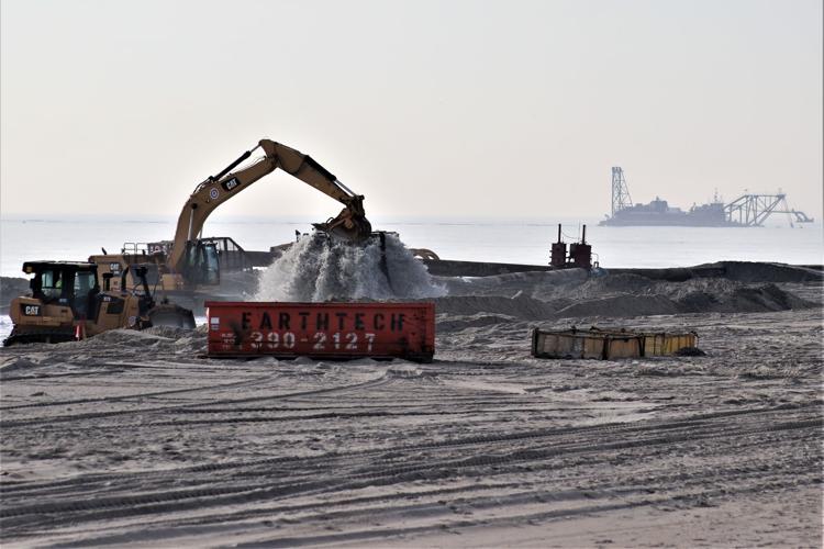
STRATHMERE – In 30 years, beach replenishment has become routine. Once big news, the sight of an offshore dredge pumping sand from Corson’s Inlet onto beaches in Strathmere and Ocean City this winter hardly raised an eyebrow among locals, much less drawing crowds to watch the progress, as an Ocean City beach project did in the 1990s.
At this point, most of Cape May County’s ocean beaches have been rebuilt from erosion at some point in recent decades, some several times. Spending on restoring beaches in New Jersey topped the $1 billion mark some years ago, with much of that funding provided by the federal government in projects overseen by the Army Corps of Engineers.
Now, Corps engineers are looking at the other side of the barrier islands, weighing possibilities for protecting beach towns on the bayside. A March 2019 Army Corps report (http://bit.ly/31WDPAc) projected damages averaging over $1.57 billion a year, over the next 50 years, if steps are not taken.
Flooded Future
Flooding on the bayside of barrier island communities could have a bigger impact than what happens on the coastal side in future storms, according to Stewart Farrell, who founded and heads the Coastal Research Center at Stockton University.
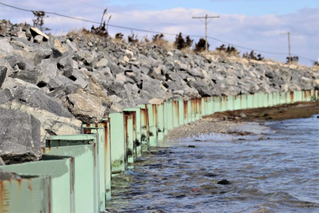
The beach sides of barrier islands tend to be at a higher elevation than the bayside, Farrell said. They also have the protection of bulkheads, and most now have a healthy dune system, “plus lots and lots of sand as a result of beach fills.”
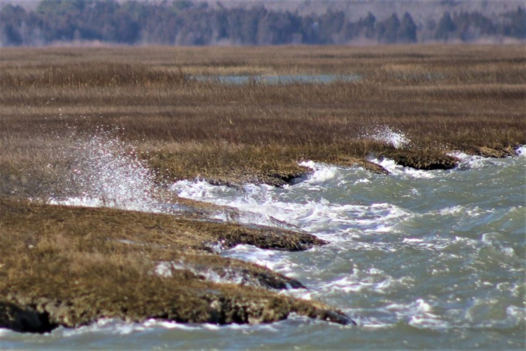
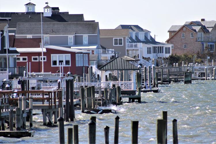
While many island communities have bulkheads along the bays, they are inconsistent, plus there are also sections, in most towns, where the streets sit just above the level of the nearby marsh, allowing floodwater to roll into town during high tides.
Water can also back up storm drains in some areas.
When Hurricane Sandy hit Cape May County, many neighborhoods were deluged from water coming in from back bays.
Three Choices
Farrell said there is no doubt sea levels are rising, and there is every reason to believe that trend will continue in the coming years and decades. Coupled with more frequent and more severe storms expected as a result of warmer seas, he said, beach towns will have to adjust to the change.
“You’ve got three choices, basically,” Farrell said. Towns can follow Holland and New Orleans and dike in the entire community, or bring in enough material from outside the barrier island to raise everything about 10 feet.
“The third option is to walk away,” he said.
None of the choices are cheap.
The first option would mean more than just bulkheads, Farrell said. It would require dikes around the barrier islands.
“That will mean that all of the rainwater has to be pumped out. Every drop,” he said.
He did not come up with the three options. That was James Titus, a researcher with the U.S. Environmental Protection Agency. Decades ago, he looked at possibilities for Long Beach Island, Farrell said, and concluded that the cost of raising the entire island would be roughly the same as the entire value of the properties there.
With total assessed value in the hundreds of billions of dollars and a booming tourist economy based on Jersey’s beaches, few will find a retreat from the coast an appealing option.
Army Corps Proposals
In March 2019, the Army Corps of Engineers released a feasibility study of possible protections for New Jersey’s back bays. Coming in shy of 250 pages, the report looks at a range of possibilities for protecting the bay sides of barrier island communities, including what will happen if no action is taken.
The Army Corps has, what it describes as, a comprehensive coastal storm risk management strategy, or CSRM, for the ocean side of barrier islands, but there is no strategy in place along the bays. That meant the region got hit hard in Hurricane Sandy in 2012, and in coastal storms since then, the report states, damaging property and disrupting lives.
“Further vulnerability to coastal storms and the potential for future, more devastating events due to changing sea level and climate change is significant,” the report states. The report divides the state into four regions, including the South Region, which includes the barrier island towns of Cape May County and portions of Somers Point.
The report evaluates and compares the costs and benefits of several options, including doing nothing and a managed retreat from the coastline. The report also looks at retrofitting buildings, a process that includes raising structures as has been underway since Sandy, and improving evacuations in coastal storms.
The report also evaluates several structural options, including familiar proposals like bulkheads, levees and seawalls. There are also options for permanent flood walls in steel or concrete along the bays, as well as for floodwalls that can be rapidly deployed as storms bear down.
The report contemplates installing protective gates at the entrances to inlets, which would allow boats and tides to pass, but could be closed in advance of a storm surge.
The report found that closing four inlets in Cape May County could make economic sense, but there are potential environmental issues in Hereford Inlet. The cost of such a project would be in the billions.
The Army Corps is looking at about $10 billion in projects, according to J. B. Smith, the project manager for the back bay study, but it could prevent $1.7 billion in damages each year, he said, which means the proposals have some economic justification.
“All of our studies go through these economic analyses. That benefit-cost ratio is fundamental,” he said.
The next step in the process will be a draft report due in March. It will likely be the late 2020s before homeowners start to see any work underway, depending on whether Congress authorizes funding.
While awareness of flooding concerns have grown since Sandy, and flood protections have improved, property values continue to rise on the barrier islands, as bigger projects continue to be built, while evidence shows the water levels also continue to rise.
“It’s a very difficult problem that’s going to require some tough choices. It takes good engineering and foresight,” Smith said.
Steps Underway
In Strathmere, Upper Township Engineer Paul Dietrich has explored a number of possibilities to keep bay water out of town in future storms. Upper Township Committee approved an increase in the heights of bulkheads, to go to eight feet over the next decade, and Dietrich has talked to elected officials about how to prevent rising water from rolling across the marsh and into town.
One idea has included building a berm along the marsh. In a recent interview, Dietrich said he’s pulled back from that proposal because the cost would not be justified to protect the existing properties. He’s looking at different options, including raising both the structures and the roads and infrastructure that serve them.
Ocean City is exploring a similar possibility for its south end. While many of the properties along lagoons and facing the open bay in the north end of town are lined with bulkheads, most areas along the wetlands have little but marsh grass between roads and properties, and the channels and bays beyond.
According to Ocean City spokesman Doug Bergen, the firm ACT Engineering is exploring four potential mitigation methods for the city’s south end, where there are no bulkheads between neighborhoods and tidal waters.
Possibilities include modifying the existing berm that once served as the bed of an out-of-use railway, raising grades, a sheet-pile retaining wall or a new landscape berm at the edge of the marshes.
“They’re taking into consideration design, engineering, permitting, estimated wetlands disturbance, estimated costs, estimated number of impacted properties and estimated timeframe of each method,” Bergen said. This spring, the firm will conduct soil investigations to help determine the effect of extreme high tides on the water table.
The city would likely decide on the best option sometime this year, he said.
Ocean City has also explored the concepts of living shoreline, working with the state Department of Environmental Protection to restore a marshy island to the west of the city to its previous size, using materials dredged from nearby waterways.
According to the federal report, there is no doubt that sea levels are rising around the world. Recent reports show sea ice around Antarctica is melting faster than expected, and glaciers are in retreat in the far north. The federal study reports warmer, less salty oceans as a result.
“Rising sea levels represent an inexorable process, causing numerous, significant water resource problems such as: increased widespread flooding along the coast; changes in salinity gradients in estuarine areas that impact ecosystems; increased inundation at high tide; decreased capacity for stormwater drainage; and declining reliability of critical infrastructure services such as transportation, power, and communications,” the Army Corp report states. “Addressing these problems requires a paradigm shift in how we work, live, travel, and play in a sustainable manner, as a large extent of the area is at a very high risk of coastal storm damage as sea levels continue to rise.”
To contact Bill Barlow, email bbarlow@cmcherald.com.
This story was produced in collaboration with the New Jersey Sustainability Reporting Hub project. It was originally reported by Bill Barlow for the Cape May County Herald, and may be re-distributed through the Creative Commons License, with attribution.

